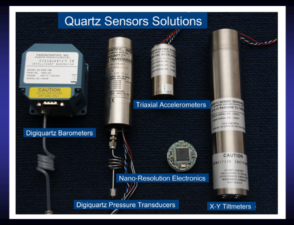
Geophysical measurements can now be made with unprecedented clarity from beneath the seafloor, to the ocean bottom, through the water column and through the atmosphere in a single coherent array. These sensors improve the identification and prediction of the magnitude, location, and path of natural disasters such as earthquakes, tsunamis and severe weather with increased warning times. Seismic + Oceanic Sensors (SOS) for Ocean Disasters and Geodesy modules have been developed for both disaster warning and geodetic measurements. The instrumentation package includes deep-sea absolute pressure gauges, a triaxial accelerometer, and nano-resolution processing electronics. An in-situ calibration system eliminates pressure sensor drift. The SOS modules work in cabled systems, in remote ocean bottom recorders, and in underwater vehicles. The sensors can also be used for strap-down AUV gravity surveys.


